| diagram | 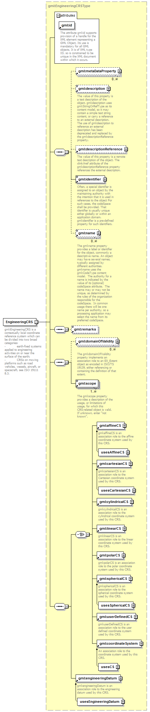 |
||||||||||||||
| namespace | http://www.opengis.net/gml/3.2 | ||||||||||||||
| type | gml:EngineeringCRSType | ||||||||||||||
| properties |
|
||||||||||||||
| children | gml:metaDataProperty gml:description gml:descriptionReference gml:identifier gml:name gml:remarks gml:domainOfValidity gml:scope gml:affineCS gml:cartesianCS gml:cylindricalCS gml:linearCS gml:polarCS gml:sphericalCS gml:userDefinedCS gml:coordinateSystem gml:engineeringDatum | ||||||||||||||
| used by |
|
||||||||||||||
| attributes |
|
||||||||||||||
| annotation |
|
||||||||||||||
| source | <element name="EngineeringCRS" type="gml:EngineeringCRSType" substitutionGroup="gml:AbstractSingleCRS"> <annotation> <documentation>gml:EngineeringCRS is a contextually local coordinate reference system which can be divided into two broad categories: - earth-fixed systems applied to engineering activities on or near the surface of the earth; - CRSs on moving platforms such as road vehicles, vessels, aircraft, or spacecraft, see ISO 19111 8.3.</documentation> </annotation> </element> |
XML Schema documentation generated by XMLSpy Schema Editor http://www.altova.com/xmlspy