| diagram |
 |
| namespace |
http://www.opengis.net/swe/2.0 |
| type |
swe:VectorType |
| properties |
| content | complex | | substGrp | swe:AbstractDataComponent |
|
| children |
swe:extension swe:identifier swe:label swe:description swe:coordinate |
| used by |
|
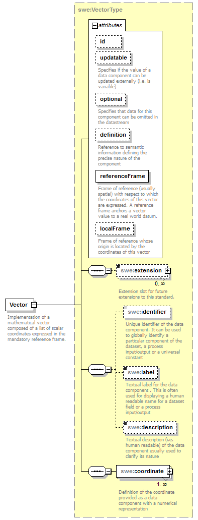
| attributes |
| Name | Type | Use | Default | Fixed | annotation | | id | ID | optional | | | | | updatable | boolean | optional | | | | documentation | | Specifies if the value of a data component can be updated externally (i.e. is variable) |
| | optional | boolean | optional | false | | | documentation | | Specifies that data for this component can be omitted in the datastream |
| | definition | anyURI | optional | | | | documentation | | Reference to semantic information defining the precise nature of the component |
| | referenceFrame | anyURI | required | | | | documentation | | Frame of reference (usually spatial) with respect to which the coordinates of this vector are expressed. A reference frame anchors a vector value to a real world datum. |
| | localFrame | anyURI | optional | | | | documentation | | Frame of reference whose origin is located by the coordinates of this vector |
|
|
| annotation |
| documentation | | Implementation of a mathematical vector composed of a list of scalar coordinates expressed in the mandatory reference frame. |
|
| source |
<element name="Vector" type="swe:VectorType" substitutionGroup="swe:AbstractDataComponent">
<annotation>
<documentation>Implementation of a mathematical vector composed of a list of scalar coordinates expressed in the mandatory reference frame.</documentation>
</annotation>
</element> |